Thursday July 31, 1997
Teslin Lake, Yukon Territory, Canada to Kitwanga, British Columbia, Canada
Canada's Flag
Current Time
GMT (+0):18:37
Seattle (-8):10:37
Kitwanga (-8):10:37

Kitwanga, British Columbia, Canada :
Latitude:55° 6' 50" North
Longitude:128° 2' 3" West
From Seattle:631 miles
Altitude:724 feet
Lodging:Camp - Cassiar RV Park
Map

Today's Travel:
Country:Canada
Regions:Yukon Territory
British Columbia
Route:SR1 (Alaska Highway), SR37 (Cassiar Highway), SR37A (Stewart / Hyder Access), SR37
Road Miles:663 miles
Linear:439 miles
Weather:Partial Sun / Rain / Partial Sun
Map

Available Photos:
All photo images © 1997-2000 Anthony Jones
Images may not be used without prior written approval.
Photo
Subject:Black Bear
Location:Cassiar Highway, ~Mile 300, BC, Canada
Larger image available
Photo
Subject:Black Bear
Location:Cassiar Highway, ~Mile 300, BC, Canada
Photo
Subject:Black Bear
Location:Cassiar Highway, ~Mile 300, BC, Canada
Photo
Subject:Black Bear
Location:Cassiar Highway, ~Mile 300, BC, Canada
Photo
Subject:Bear Glacier
Location:SR 37A, BC, Canada
Photo
Subject:Bear Glacier w/ Cave
Location:SR 37A, BC, Canada
Larger image available
Photo
Subject:Bear Glacier
Location:SR 37A, BC, Canada
Photo
Subject:Bear Glacier
Location:SR 37A, BC, Canada
Photo
Subject:Bear Glacier
Location:SR 37A, BC, Canada
Larger image available
Photo
Subject:Evening light up valley
Location:Bear Glacier, SR 37A, BC, Canada
Photo
Subject:Black Bear
Location:SR 37A, BC, Canada
Larger image available

Trip to Date:
Day:112
Miles Driven:21893
Linear Dist:19862
Countries Visited:2
Regions Visited:38
Nights in Hotels:30
Nights with Friends / Family:38
Nights Camping:33
Nights in Hostels:7
Nights in Transit:4
Beers:343
Map

Entry:
In the morning we drove about 150 miles to the start of the Cassiar. Managed to destroy my windshield on the way when a truck going the other way kicked up a rock, (a 4 inch hole). We spent most of the day driving the 450 miles of the most beautiful road I've ever been on, the Cassiar Highway.

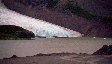
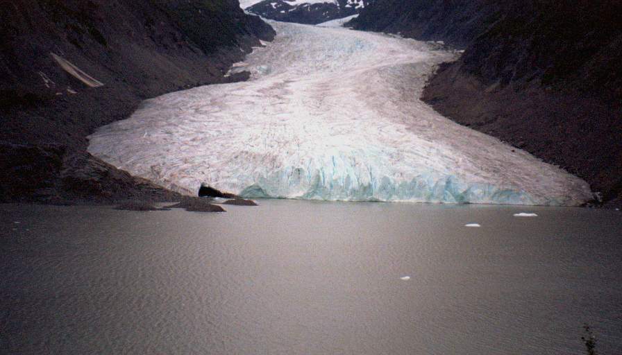
We saw bears! Quite a few. We also got lost (took Route 37A instead of 37) and saw a couple beaver swimming (and diving when they saw us), more bears, and a spectacular glacier, Bear Glacier. We both agreed it was the best 50 miles we'd spent, (even if it was an accident).

We ended up spending the night at a commercial campground, but that was OK because it was late and we were a little worried about all the bears we'd seen.


[Previous Day] | [Index] | [Next Day]

Back To: Welcome Page