-
Tuesday, September 23, 1997
-
Helsinki, Finland

|
| Helsinki, Finland: | |||||||||||
|
|||||||||||
| Today's Travel: | |||||||||||||||||||
|
|||||||||||||||||||
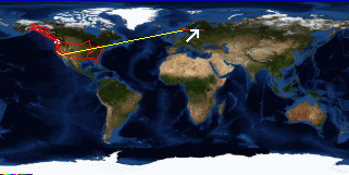
| Trip Stats to Date: | |||||||||||||||||||||||||
|
|||||||||||||||||||||||||
Back at the hostel spent way to many hours doing my laundry (waiting for the dryer).


