. OnHiatus.com > Journal 1 > Day Index > Journal Entry: March 12, 1998

Thursday, March 12, 1998
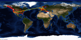
Ankara to Antakya, Turkey
Turkey's FlagCentral Anatolia's FlagAntalya's Flag

Map
Antakya, Turkey:
Latitude: 36° 12' 19" North
Longitude: 36° 9' 48" East
Altitude: 494 feet
From Seattle: 8132 miles
Lodging: Hotel - Hotel Saray

Map
Today's Travel:
Country: Turkey
Regions: Central Anatolia, Antalya
Route: Bus:Ankara - Antakya
Path:Ankara - Antakya, Turkey
Linear:343 miles
Weather: Snow

Click on map to Zoom in...
Map
Trip Stats to Date:
Day: 336
Linear Dist: 96130
Countries Visited: 27
Regions Visited: 107
More stats...
Hotels: 55
Friends / Family: 98
Camping: 38
Hostels: 113
Transit: 32
Beers: 1417
Hide...

Journal Entry:
Last night I made the mistake of asking someoe at the embassy party if it ever snowed in Ankara. This morning it's dumping the stuff. I have to waste time until two when I can pick up my visa. Spent the morning lounging around the hotel, went and had some tea and read, and came here to check my email. Not sure where I'm going to end up tonight, I'm sceptacal of being able to catch a bus to Antakaya (near the Syrian border), so I'll probably end up someplace between here and there, maybe back in Cappadocia (I wouldn't mind seeing it in the snow...)

I got the visa (finally)! I only had to wait outside in the dumping snow for 40 minutes for the embassy worker to call my name. Caught a direct bus to Antakya. Got a room at the hotel where the Laura, Jeanne, and Rachel are staying at a little after 2am.


Related Sites:
CNN: Current Weather in Ankara
US State Department Consular Information Sheets: Turkey
CIA World Fact Book: Turkey

Paging: [⇚ Mar 11] | [Mar 13 ⇛] OnHiatus.com > Journal 1 > Day Index > Journal Entry: March 12, 1998