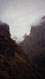
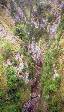
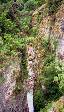
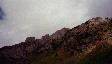
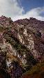
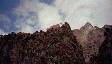
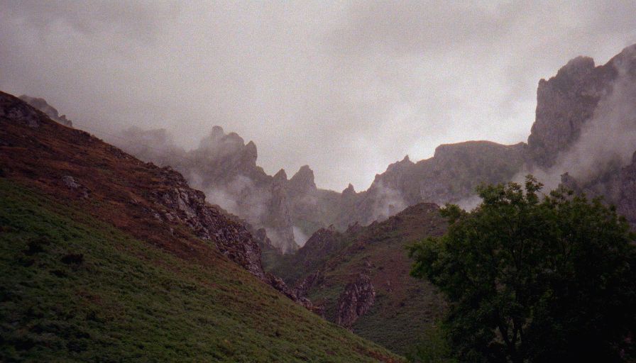
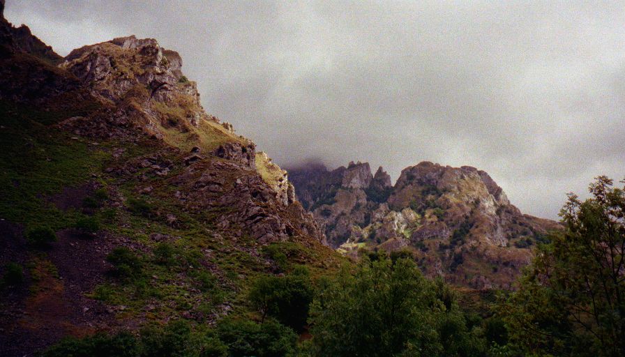
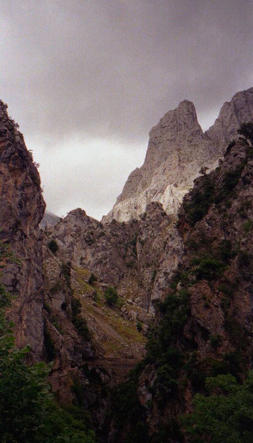
The alarm woke me up at 8:30. It was pouring rain, and while I was willing to hike in a light rain I didn't feel like drowning, so I set the alarm for ten and went back to sleep. Woke up to sunshine and at least partially blue skies. Went to breakfast, got my gear together and set off to find a trail map. Got one at the tourist office. About now I realized that the 12km hike I'd read about that sounded like such a good idea on the train between Bilbao and Santiander was really a 6km hike to the trailhead, the 12km trail (6 out, six back), and 6km back from the trailhead. Still undaunted (well, maybe lightly) I set out. Of course within minutes it's raining... hard. Twenty minutes from town and I'm already drenched to the bone, but at least it's not cold. It's a bit scary since the road is very windy and narrow, there isn't anyplace to walk (rock face on one side, sheer drop on the other), and the locals drive fast. Plus the sound of the cars was muffled by the rain, my hood, and the river so I often couldn't hear approaching cars. At least it was scenic, most of the walk being inside the national park. Parque Nacional de Los Picos de Europa is Eurpoes largest national park. It's very rugged, slightly reminicent of the Grand Tetons. After about an hour and a half I was at the trail head to the Routa del Cares.
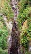
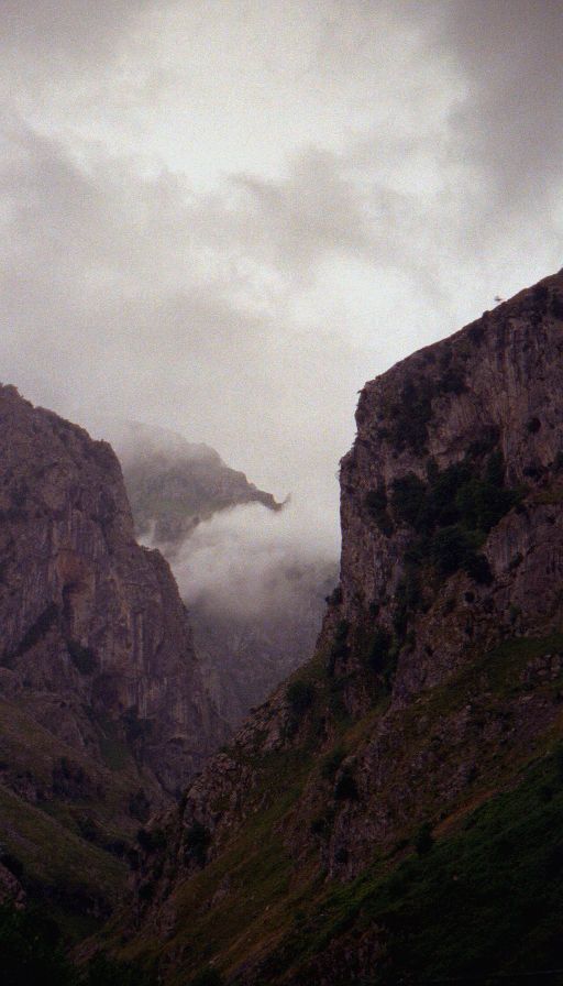
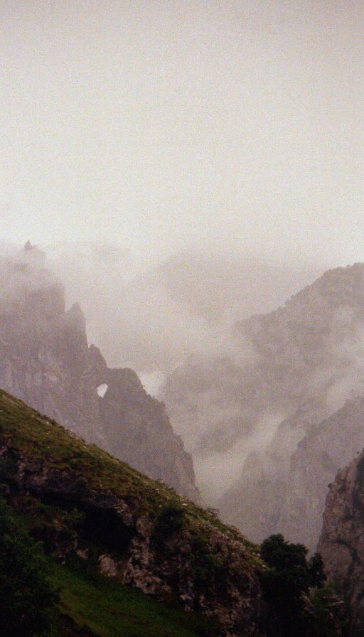
About 30 minutes into the trail it stopped raining, about 30 minutes after that the sun broke through. I took off my jacket, packed it up and it of course immeadiately started raining again. The tral is pretty amazing, it's been blasted out of the sheer rock walls of the Rio Cares canyon at the start it's maybe 1000 feet above the river (straight down, overhang in places), near the end (in Cain ) it's adjacent, between is six bridges, who knows how many tunnels, heards of mostly tame mountain goats, and some of the most fantastic scenery ever. I ended up being thankful for the rain because even in the horrible weather I was still passing groups of hikers about every five minutes. With my dislike of crowds I would probably have been miserable on a sunny Sunday in August.
By the time I got to Cain (the end of the trail - at least for me) I was starting to realize that I am not in very good shape. My legs were hurting, and my feet felt absolutely bruised, and I was very unhappy to realize that the trail was eight km each way (not six as advertised). I sat down in the restaurant (there's only one) and had a big hour plus lunch and felt pretty good as I started off again. The hike back was mostly dry and there were even a couple of sunbreaks, one of which lasted a full half hour. Less people and the occasional sunshine made for a wonderful hike. Then I was back at the trail head. It was almost 8pm and I still had the 6km walk back to the hotel. I was ready for the hike to be over. It was a very long, painful, and wet walk back. I got in at a little after nine, took off my wet clothing, craweled into bed, and now I'm about to go to sleep. Total for the day was 28km (16.8 miles) more than double what I was thinking... Goodnight.


