I don't think I slept at all last night. I made at least ten trips to the toilet, had a severe headache and a mild fever, and felt nauseous. When I got up I took some pain killer and Imodium and the nausea seemed to have gone away. I went to join the group for breakfast and managed to drink half a cup of tea, but as soon as the food came out I had to leave quickly. Back at the hotel I took a anti-nausea pill and a Diamox (for the altitude) - I really was not happy about taking so many pills, but I was barely functional so something needed to be done. The rest of the day was spent in the car on very rough roads - I was completely miserable except for when something absolutely fantastic distracted me.
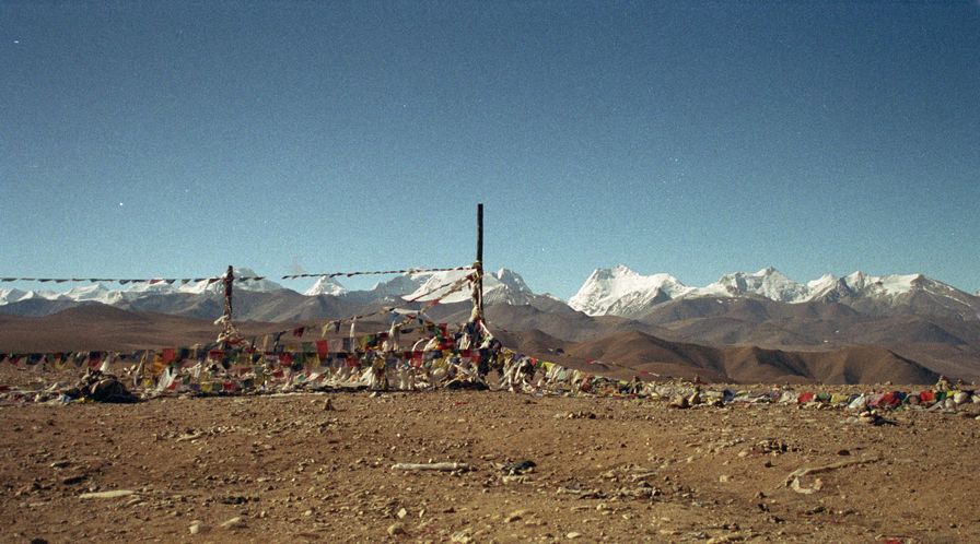
We drove for almost two hours and then stopped at the top of Tonga-la Pass - 16,744 feet above sea level! There were amazing mountain views of the Himalayas and (I think) Shisha Palma Mountain - one of Tibet's eight thousand meter peaks (26,000+ feet). There was also the usual, but still fascinating, cairns and prayer flags, plus a lot of sheep horns and skulls?! From the pass the landscape started to look more and more like the surface of the moon - completely desolate but with the occasional glimpse of some snow covered peak and the bluest sky imaginable.
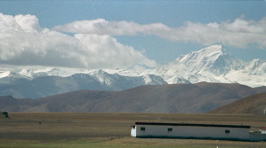
A couple hours further we reached a good stretch of road and the clouds on the horizon lifted enough for us to see... Mount Everest! It was very cool and there was also a picturesque little village and a herd of Yaks to keep us amused - I hardly even noticed that I felt terrible for the duration.
We stopped at the little nondescript town of Tingley for lunch, but I only manages about half a cup of rice soup (rice and water). After lunch we had a long hellish (very rough) drive. I spent most of my time in the car with my eyes shut only opening them when someone commented on something or we hit an especially nasty bump. It's too bad as I really loved the scenery. Four hours of driving got us to Gyatso-la pass - with an altitude of 17,258 feet it's the highest spot between Katmandu and Lhasa. By this time it had clouded over and actually began to snow lightly so the mountain views weren't there to distract me and I felt terrible. I took a few minutes to take a couple photos and check the GPS (this was definitely the highest I've ever been - at least outside an airplane).
From the pass another hour got us to Lhatse, our stopping place for the night. I still felt terrible, so didn't even consider looking around. I laid down for an hour then felt much better - just an altitude headache. I even managed to eat a plate of vegetable momos for diner. Then it was to bed just after nine o'clock - it was still totally daylight outside, but that didn't stop me!


