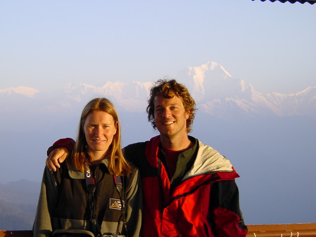
I couldn't sleep last night - I don't know why. Sometime very early in the morning I looked out the window and saw a million stars - the sky was clear, the mountains were going to be glorious. So when the alarm went off at 4:40 I was waiting for it. We put on all our warm clothing, grabbed the cameras and headed out the door. The hike was cold and hard - I really felt the thin air and by the time we finished the 45 minute hike up Poon Hill my lungs, ears, and throat all felt raw. But the mountains were amazing. The glow of the sunrise caught the very peak of Annapurna South and then slowly traveled down. First the peak, then the connecting ridges caught fire - it really was glorious. There was several other giant peaks. The next most impressive one was a pyramid shaped Everest look-a-like that had a beautiful spray of snow being driven off the peak by the wind. We were somewhere above 10,000 feet and still the mountains towered above us - Annapurna was more than fourteen thousand feet above us!
After hanging out for an hour and a half we took it easy on the hike down. Back at our tea house we had an ok breakfast and discussed our plans with some other hikers and a couple guides. We were heading to Tadopani, but just yesterday a lone hiker had been stabbed and robbed on the trail we had to take. After consideration we decided to talk to the police and maybe also look for others to hike with. The police said there should be no problems but we should stay aware and stick together. We set off down the trail and soon forgot our worries. The peaks were so impressive that every time I looked up to see if they were really as grand as I remembered them I'd be stunned and have to stop and stare or risk tripping over my own feet. The trail was different from the one we've been on. It's a lot more like what I had expected - much more primitive - sort of like what backcountry trail in a national park would be like. Also there was a lot less traffic - a little worrisome as we were hoping to find others to hike with. The first hour and a half out of Ghorepani was all up hill and very steep. At the top we saw another group of trekkers and kept them within sight - probably unnecessary, but it made us feel better. After the uphill part it got worse - it was all down hill and still very steep.
About three hours into our hike we stopped for lunch (in Banthanti) - it was a little disappointing and while we were eating the weather started to turn gray and cold. We continued trekking an came to another long uphill stretch - about forty-five minutes worth. At the top we found Tadopani - our destination for the day. We checked in to the Hotel Panorama Point, but were a little disappointed by the view. The hotel is a classic old tea house - crumbling brick walls and crude wood floors. When the sleeping room had been divided into separate "hotel" rooms the walls were constructed so they're several inches short of the floor or ceiling - but that didn't matter as there were quarter inch gaps in the walls anyway. It was perfect - much more like what I had been expecting! Plus we still got a hot shower. As we arrived at the hotel it started raining (great timing!) After getting our gear unloaded and showering I spent an hour going through the photos I'd taken today - there were a couple fantastic shots. Unfortunately I ran the last of my battery down, so no digital photos until I can find electricity (certainly not here!) Later when we went down to the kitchen to get something warm to drink we found the rain had cleared the air some and we could see the mountains again - panorama does not do the view justice.
Spent the rest of the afternoon reading in the hall (the only heated room) or wandering through the village (only took a few minutes as it's typically small). After diner I was going to get caught up on my journal but I couldn't keep my eyes open and went to bed around 8:30.


