-
Friday, March 31, 2000
-
Te Anau to Queenstown, New Zealand
|
| Queenstown, New Zealand: | |||||||||||
|
|||||||||||
| Today's Travel: | |||||||||||||
|
|||||||||||||
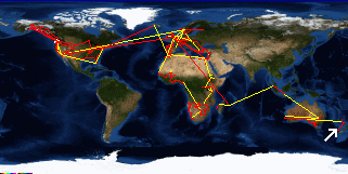
| Trip Stats to Date: | |||||||||||||||||||||||||||
|
|||||||||||||||||||||||||||


