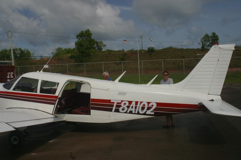
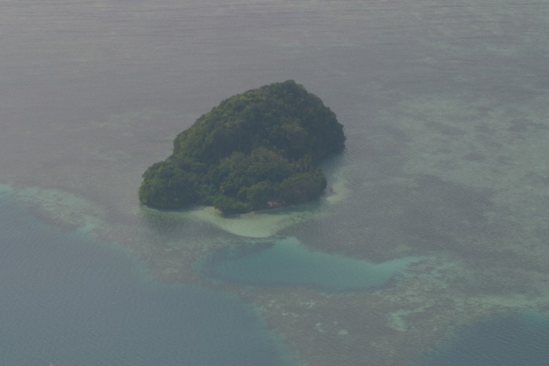
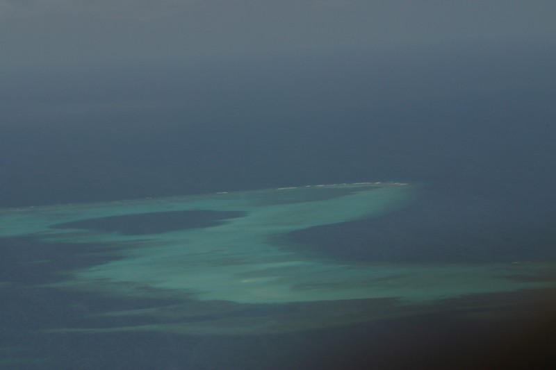
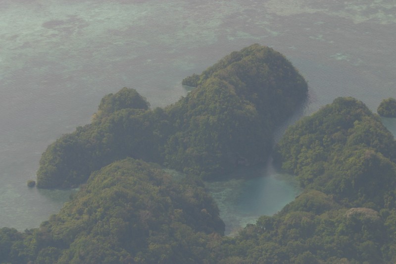
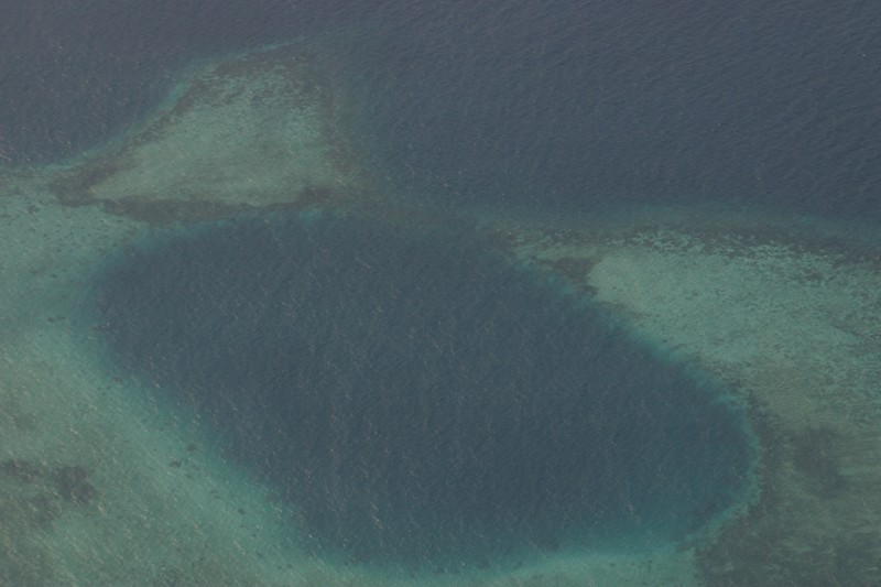
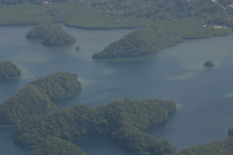
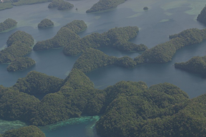
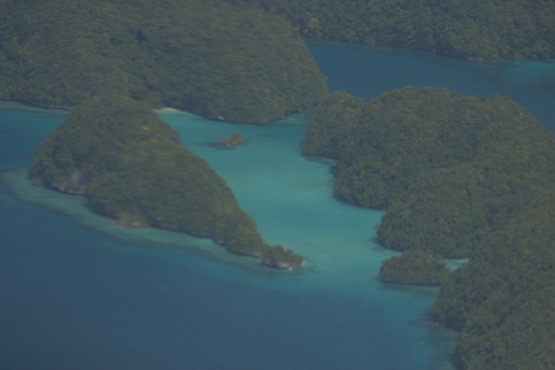
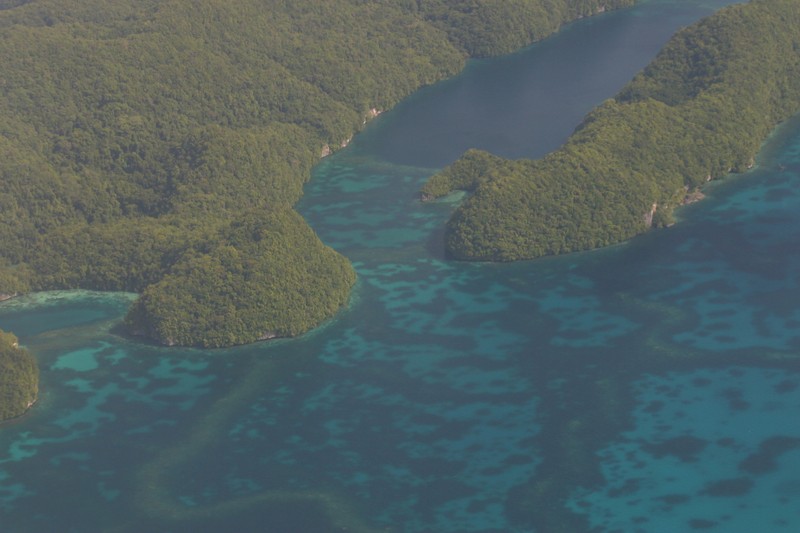
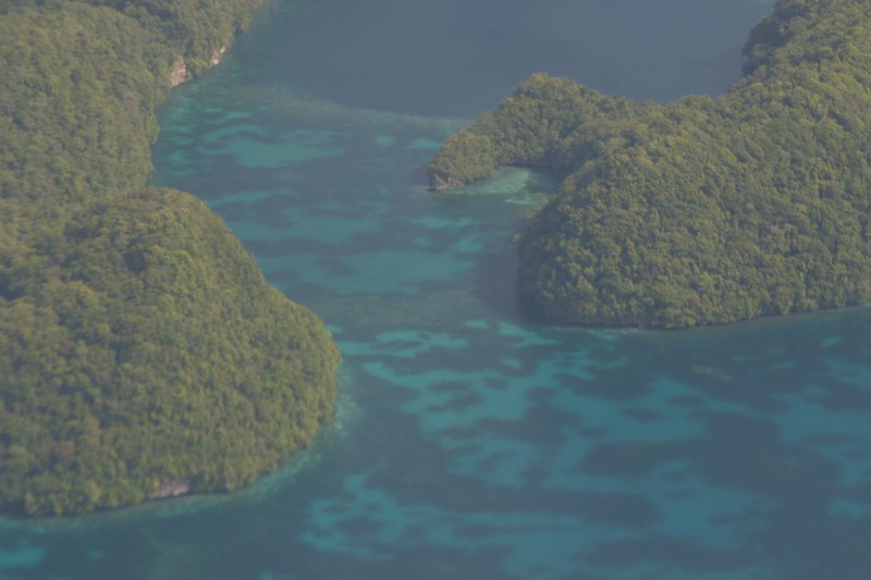
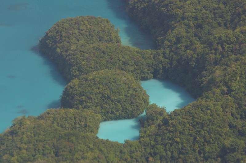
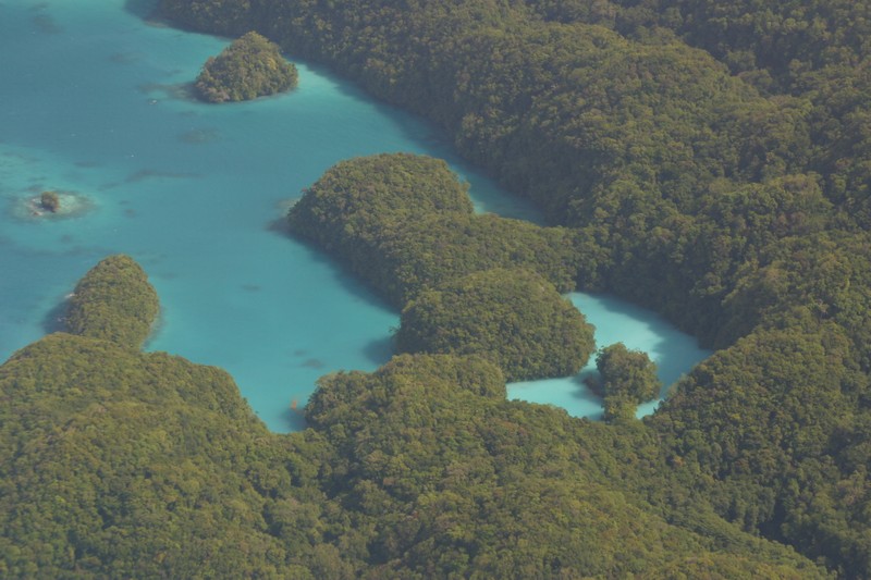
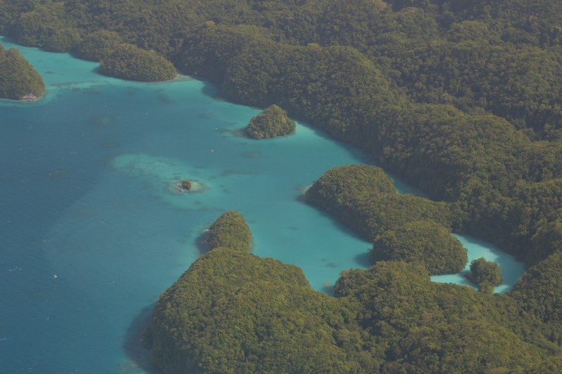
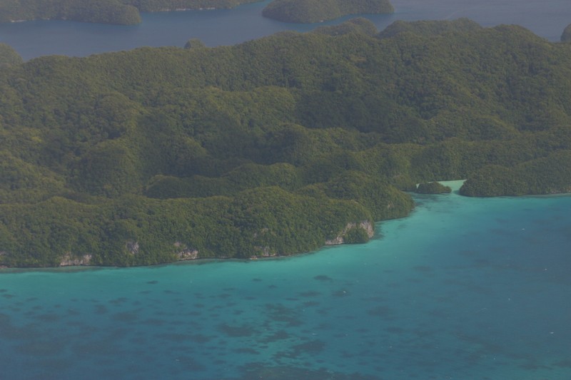
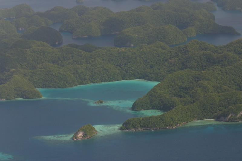
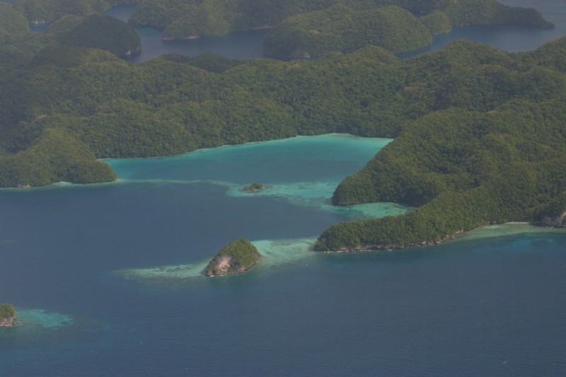
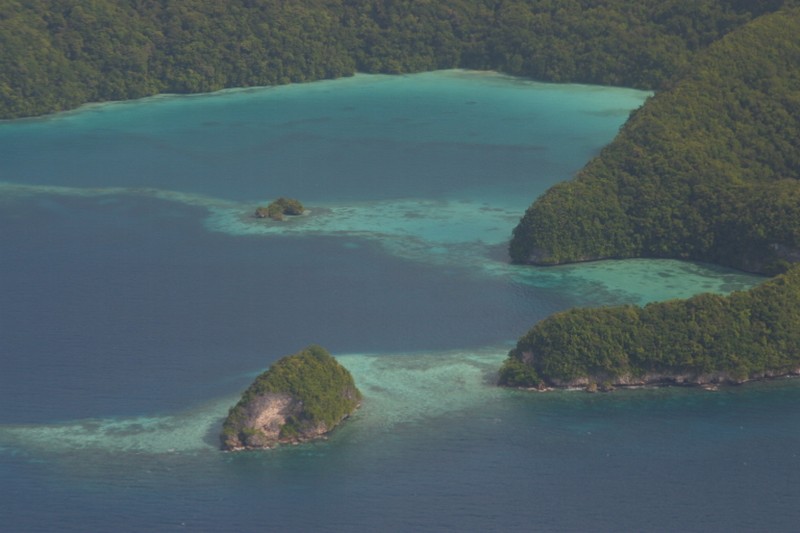
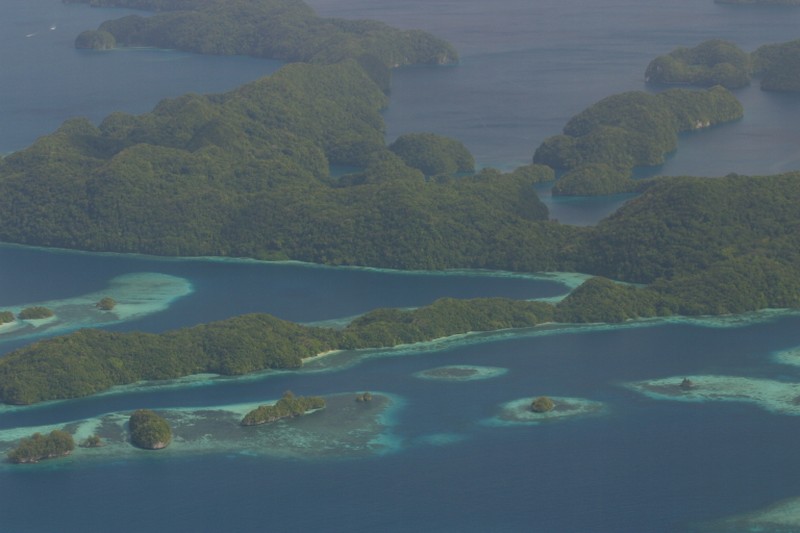
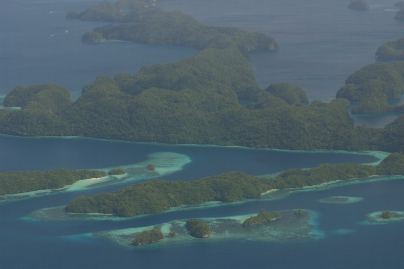
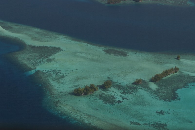
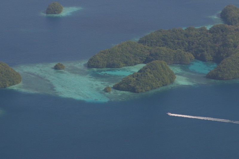
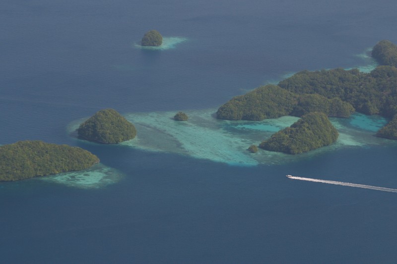
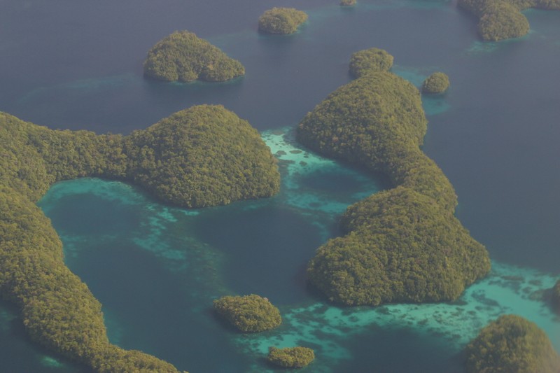
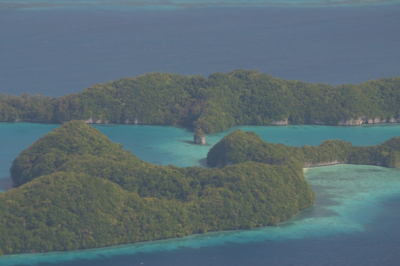
Packed and ready to go about 7:15. Bill had volunteered to drive us so we could easily stop at the supermarket. Unfortunately it was closed - we then tried three or four others (two were closed, and the Mobil Mart was useless) before ending up at the Korean store where we were able to scrounge enough. At the airline office we quickly changed our reservations (just going to Anguar and back to Koror now), bought our tickets and were on the shuttle to the airport. The plane is a small single prop Piper - looking a little worse for the wear. However, the takeoff was smooth and the short flight was gorgeous. The Rock Islands are incredible - emerald green flowing shapes set in the most fantastic shades of blue. The very smooth landing was on a huge old runway - over a mile long and just cleared out of the forest so the runway itself is the old coral limestone - no paving. I'm guessing that it's left over from W.W.II.
Anguar's "terminal" consists of a couple old benches. A man drove by in a pickup and asked if we were waiting for Leon - since we'd arranged to stay at Leon's guest house we said we were and he agreed to let him know we were there. A few minutes later Leon showed up and drove us to the guest house. He has two guest houses, the beach on had been recommended to us but wasn't available, so we had no idea what to expect - probably something pretty primitive. What we got was air-con, a clean kitchen, a couple TVs with VCRs, and even hot water! There is another couple staying in the house, but we only saw them briefly.
After unpacking and taking a breather we set out to explore the northern coast of the island. The island is very small (3.8 square miles) so we figured we could explore on foot. We made it to the dock alright and stopped to admire the surf. Anguar is not inside the protective reef, so the open ocean is right there. From the dock we took a wrong turn and ended up in the middle of the island. By the time we figured out our mistake we were way out of the way so we decided to explore the phosphate mines, W.W.II relics, and inland lakes. There was dense greenery on both sides of the roads - so even though it was hot we at least were walking in the shade. There were a lot of very different trees from Koror or Pohnpei. Mixed in with the usual coconut and betel nut palms there was a kind of pine trees, lots of ferns, huge Banyan type trees, orchids, and a ton of things I couldn't even begin to recognize. The overall feeling was that of a forest rather than tropical jungle - at times it felt almost alpine - except you could always here the surf.
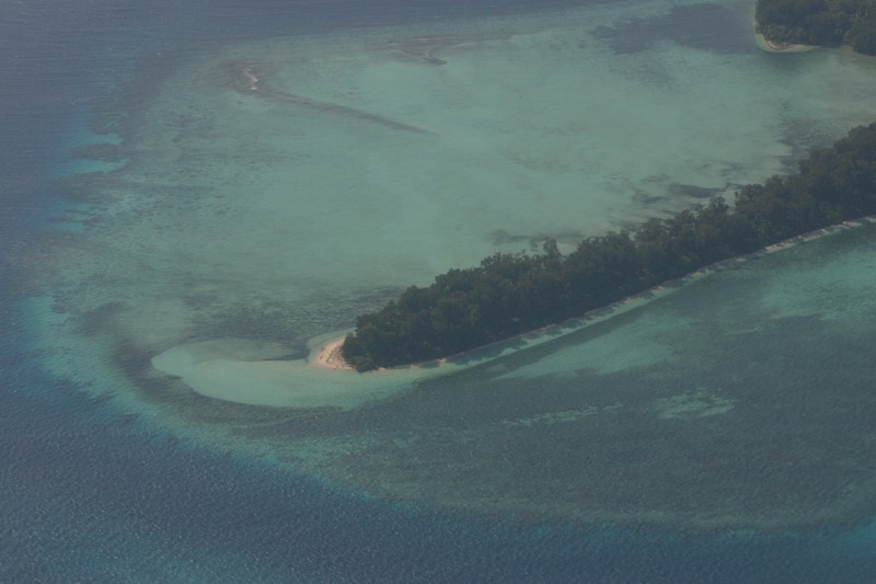
After a couple hours we'd managed to circle to lakes and find our way to the north side of the island. This is where we'd meant to go, but we'd already been walking far longer than we'd planned, so we took the short direction along the coast towards the guest house. We stopped for a few minutes at the Liberation Monument honoring the US Army (who liberated Anguar from the Japanese in 1944) to watch the Macaque monkeys that infest the island. The coast is composed of very jagged coral chunks - beautiful to look at but a razor sharp barrier to actually getting to the water. The road ran about ten yards away from the water, but it was virtually impossible to get to. On the bright side the jagged shoreline made for so pretty blow holes - I'd love to watch when the surf was big! Finally on the west side of the island we were looking at the Japanese Peace monument when Sue found a path down to a sandy beach. The tide was pretty low so the sand butted up against the reef flats, but we spent a while exploring the tide pools (I saw several little moray eels that would actually "swim" across the dry rocks to get away from me), and the rusting military hardware that was embedded in the reef after almost sixty years. I'm guessing that the rusting bits still visible used to be a couple amphibious landing crafts (I thought I could see where a tread once was). From the beach it was actually a pretty short walk back to home.
By the time we got home we'd been walking almost non-stop for four and a half hours. Lunch was long overdue so we made some sandwiches and snacks. We were all feeling a little tired so we sat around reading for a few hours then walked down to the dock to watch the sunset. The horizon was behind clouds so there wasn't much of a light show(we'd been hoping to see the green flash), but it was still very nice sitting on the jetty watching the coral distorted by the shape of crystal clear waves rolling over it. Back at the house the management had brought us a huge diner - again much more and much better than expected (though we don't know how much it's going to cost us). After eating Stacy went to bed, Sue read, and I worked on my journal and read.


